
Managing authority
Government tourism / conservation authorityMC completion certificate
Manaslu Circuit Completion Certificate
Record a completion of Manaslu Circuit in Nepal with private evidence review and a premium QR-verifiable certificate.
MCRegistry route
Image source and licence
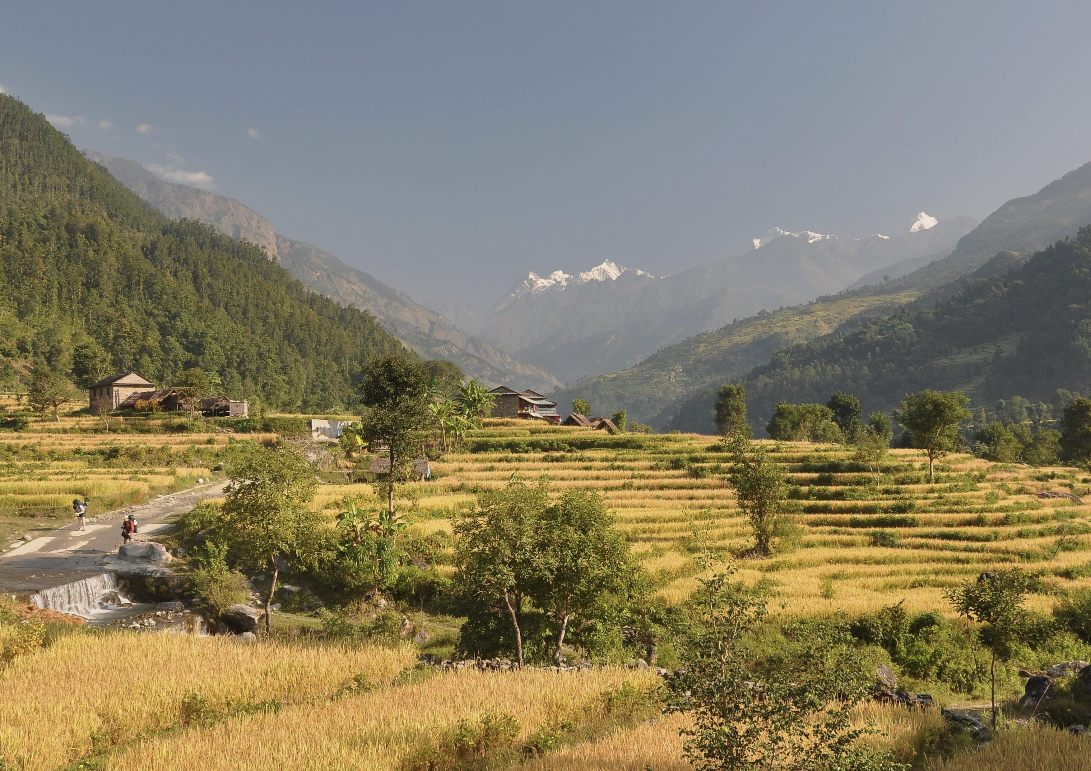
Manaslu circuit trek by Lukas Kolisko, CC BY 2.0; cropped and colour-treated.
Verification application
Sign in before you start
Authentication protects your application, payment status, and private evidence. You will return to this trail after signing in or creating an account.
Trail context
A certificate grounded in the journey.
A Manaslu Circuit record should show a coherent journey through remote river valleys, mountain settlements, and the high-pass section rather than rely on one dramatic photograph. Hikers commonly carry several daily activity files, and gaps can occur where batteries, cold, steep terrain, or limited connectivity affect recording. GPS tracks, dated route photographs, permit or itinerary context, and a credible guide or agency confirmation can support one another when their dates and scope agree. Describe the start and finish actually used, acclimatisation or weather days, side trips, and any road transfer. The certificate artwork reflects the rugged Himalayan valley character while remaining an independent registry design. Raw location files, permit identifiers, booking information, photographs, and private guide correspondence are restricted to authorised review and never appear on the QR page.
Completed Manaslu Circuit? Submit route-appropriate GPS tracks, activity links, dated photos, stamps, permits, guide confirmation, club confirmation, or a clear completion narrative. Route variants are assessed from the evidence provided.
Structured trail record
Authority, season and access
Official route status
Official restricted-area trekking route
Himalayan circuitNormal endpoints
Soti Khola / Machha Khola to Dharapani
Catalogue references: 28.132, 84.867 to 28.514, 84.350Elevation range
700 m to 5,106 m
Rounded catalogue elevationsRecommended months
March-May · October-November
Larkya La may close after snow; monsoon landslidesAccess requirements
Restricted-area permit, conservation permits and licensed guide required
Permit/booking · Guide/operator · Controlled access · Seasonal constraintsCollection and characteristics
Himalayan circuit
High AltitudeRestricted AreaTeahousesMountain Pass
Coordinates and elevations are rounded catalogue references for discovery only. They are not navigation-grade or emergency waypoints. Always use current official route information and an appropriate map.
Reviewed route data
Route, stages and elevation
Interactive map of Manaslu Circuit
170-190 km, depending on itinerary
146.67 km
7,567 m on mapped route
500–5,093 m
14-20 walking days
StartSoti Khola / Machha KholaFinishDharapani
- 1Machha Khola
- 2Namrung
- 3Samagaun
- 4Larkya La
- 5Dharapani
Planning summary only. Check current closures, permits, weather and official navigation sources before travel.
Why get this certificate?
Record a completion of Manaslu Circuit in Nepal with private evidence review and a premium QR-verifiable certificate.
Your certificate includes a premium PDF, a permanent QR verification page, registry-signed metadata, and privacy-aware public display settings.
Accepted evidence
Route-matched proof examples
- Daily GPS activities covering the valley and pass progression
- Dated photographs at settlements, bridges, valleys, or the high-pass area
- Permit and itinerary records supporting the trip window
- Guide or agency confirmation identifying route scope and dates
Before payment
Prepare proof that tells the whole route story.
Best evidence: GPX, FIT, or TCX files, trusted activity links, dated trail photos, stamps, permits, or guide confirmation. Photos alone may need supporting context.
Expected review level: Evidence Reviewed. Most reviews target 2–3 working days after payment and private proof upload.
Trail proof checklist
- GPS track file or activity link where available
- Photos at recognisable route landmarks
- Date range and completion narrative
- Permit, stamp, guide, club, or organiser confirmation where relevant
Distance and route variants are reviewed conservatively. Public pages never publish raw GPS points or private proof files.
Private review layer
Your proof is not your public profile.
Reviewers may see
GPS and activity files, uploaded photos, permits, stamps, guide confirmations, completion narrative, and clarification replies.
The public may see
Certificate status, trail, privacy-controlled display name, dates, verification level, issue date, fingerprint, and registry signature state.
Supported route variants
Accepted itineraries range from approximately 170 km to 190 km. The certificate must identify the completed variant or section and any transport links.
Explain the chosen start and finish, acclimatisation days, side valleys, weather changes, and any road transfer. A section record can be considered when the evidence does not support the full circuit.
Prepare proof for Manaslu CircuitVerification levels
Evidence ReviewedPrivate completion evidence was assessed by a Verified Hikes reviewer.
GPS Evidence ReviewedA GPS file or trusted activity record formed part of the evidence review.
Photo + GPS ReviewedPhotographic context and GPS or activity evidence both supported the review.
Partner ConfirmedAn approved partner confirmed completion through a defined workflow.
Authority ConfirmedA trail authority explicitly confirmed the record through an approved workflow.
How the process works
Start verification
Create a paid application for this trail.
Upload proof
Add GPS, activity links, photos, stamps, permits, or confirmation documents privately.
Registry review
A reviewer checks evidence, dates, privacy, and verification level.
Certificate issued
Receive your premium PDF and QR-verifiable public record.
FAQ
What does the QR code prove?
It opens a safe registry page showing certificate metadata, signature status, evidence summary, and PDF fingerprint.
Request correction
See outdated trail facts? Send a correction request so the registry team can review the route record before publication changes.
Request correction/update